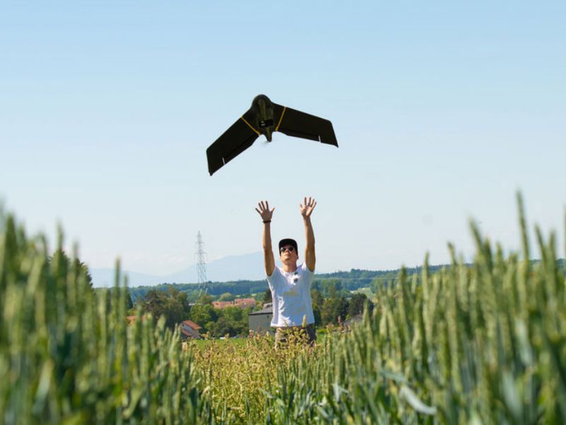
Develops and manufactures fixed-wing drones, multispectral sensors and drone software for surveying, agriculture and defense

AgEagle Aerial Systems Inc. (EagleNXT)
Allen, Texas (US headquarters)New on Amplifa
About EagleNXT
EagleNXT (formerly AgEagle Aerial Systems Inc., NYSE American: UAVS) is a provider of integrated drone solutions comprising flight hardware, sensor technology and software for commercial and government customers. The portfolio includes the eBee X Series fixed-wing mapping drones (eBee X, eBee TAC, eBee Ag, eBee Geo), tactical drones such as eBee VISION, multispectral sensors (including MicaSense RedEdge-MX) for aerial surveying and thermography, as well as BVLOS software for automated flight control and data processing. Through the ThirdEye USA joint venture, optical counter-UAS detection systems are manufactured in the USA. The drones weigh under 2 kg, can map up to 500 ha per flight and fly for up to 90 minutes. Customers come from defense, agriculture/commerce and public safety, including the French Army, UAE security forces and US armed forces. The eBee X Series is the only professional drone series certified with both EASA C2 and C6 markings. The main administrative headquarters is in Allen, Texas (USA).
- Site
- Allen, TX, USA
- Processes
- Drone manufacturing/assembly (UAV production, eBee production line), Design and engineering of flight hardware, sensors and software (full stack UAS, sensors and, Manufacture of multispectral sensors and optical detection systems (counter-UAS, MicaSense, Drone software for BVLOS operations (automated flight control, program management,, Counter-UAS systems (ThirdEye USA joint venture, local manufacturing), Multispectral sensor technology for aerial surveying, mapping and thermography, Aerial imaging data collection and analytics
- Certificates
- ISO 9001 (recertification for engineering, UAV production and sales,, EASA C6 marking (eBee X Series), EASA Design Verification Report (DVR) M2 Ground Risk Mitigation, ISO 9001, EASA C6 (NavCert NB 2603), EASA DVR M2 Ground Risk Mitigation
- Founded
- 2010 (AgEa
- Industries
- Defense/Military, Agriculture/Commerce, Public Safety, Defense/Military, Agriculture/Commerce, Public Safety
- 01
Engineering (flight hardware, sensors, software)
- 02
UAV production/assembly (eBee production line, USA)
- 03
Sensor manufacturing (multispectral/thermography)
- 04
Counter-UAS manufacturing (ThirdEye USA JV, local production)
- 05
Sales & E-commerce
Locations
Allen, Texas
USHeadquarters, UAV production and sales (USA)
- eBee VISION drone production line (USA, expanded 2024)
Drones & Sensors
Inside the production
Industries
Processes & technical limits
| Processes | Tolerance | Max. part | Weight | Lot size | Materials |
|---|---|---|---|---|---|
| Drone manufacturing/assembly (UAV production, eBee production line)Assembly | – | – | – | – | – |
| Design and engineering of flight hardware, sensors and software (full stack UAS, sensors andEngineering | – | – | – | – | – |
| Manufacture of multispectral sensors and optical detection systems (counter-UAS, MicaSenseAssembly | – | – | – | – | – |
1 Anlagen & Maschinen
| Machine | Manufacturer / model | Quantity | Working area | Year built | Site |
|---|---|---|---|---|---|
| Drone Production Line | EagleNXT/AgEagle eBee VISION | – | – | – | USA |
Additional services
Reference customers
Quality & Certification
The engineering, UAV production and sales divisions are being recertified to ISO 9001 (completion expected Q1 2025). The eBee X Series was tested by the notified body NavCert GmbH (NB 2603) under EU Regulation 2019/945 and carries the C6 and C2 markings.
| Evidence | Allen, Texas |
|---|---|
| ISO 9001 | |
| EASA C6 (NavCert NB 2603) | |
| EASA DVR M2 Ground Risk Mitigation |
Company History
- 2009
Founding of senseFly SA, a pioneer in UAV mapping
- 2010
Founding of AgEagle, originally drones and aerial image analytics for agriculture
- 2022
eBee X Series as the first drones in the industry with an EASA Design Verification Report (M2 Ground Risk Mitigation)
- 2023
EASA C6 marking for the eBee X Series (together with C2, the only drones with both markings)
- 2024
Two largest orders in company history (USD 5.5 million: French Army, UAE security forces); USD 6.5 million capital increase; 50:1 reverse stock split; focus on 3 vertical markets; establishment of an eBee VISION production line in the USA
- 2024/2025
ISO 9001 recertification of engineering, UAV production and sales expected by Q1 2025