
Surveying office for construction surveying, laser scanning, utility line locating and hydrography based in Karlsruhe

bugglin beßler Ingenieure GmbH
Karlsruhe · NeuburgNew on Amplifa
About bugglin beßler Ingenieure
bugglin beßler Ingenieure GmbH is a surveying office with locations in Karlsruhe and Neuburg (Pfalz). It emerged from the merger of the surveying offices bugglin Ingenieure GmbH and VMB Michael Beßler on 1 January 2018. The range of services includes surveying accompanying planning and construction surveying, as-built surveys on large construction sites, quantity determination in accordance with VOB, interior building surveys using digital laser technology, façade surveying, laser scanning, deformation measurements, locating and as-built recording of underground utility lines, utility line cadastres, room books, fire safety plans according to DIN 14095, DIN 4844-3 and DIN 14675, 3D animation as well as hydrography with multibeam echo sounder. The staff have experience in large projects in power plant construction (power plants, hydroelectric power plants) as well as in industrial and residential construction; further sectors are commercial construction, civil engineering, waterways and ports, gravel and sand pits, and heritage conservation. Since March 2014, the office has been certified according to the QM standard "Planer am Bau" (Planner on the Construction Site) by TÜV Rheinland – as the first surveying office in the greater Karlsruhe area.
- Site
- Karlsruhe
- Processes
- Surveying accompanying planning and construction surveying, Surveying of renovation projects (geodetic, photogrammetric and scanner-based capture), Construction-accompanying as-built surveys on large construction sites, Quantity determination (digital terrain model, volume calculation in accordance with VOB), Interior building survey with digital laser technology, Façade surveying, 3D animation for as-built records and planning, Deformation measurements
- Materials
- Laser Scanning, Digital Laser Technology, Electronic Utility Line Locating, Multibeam Echo Sounder (Hydrography), 3D Construction and Animation
- Certificates
- Planer am Bau (QM standard for architectural and engineering offices), Planer am Bau (TÜV Rheinland)
- Industries
- Power plant construction (power plants, hydroelectric power plants), Industrial construction, Residential construction, Commercial construction, Civil engineering / earthworks, Waterways and ports
- 01
Project consulting and order clarification
- 02
As-built survey (geodetic, photogrammetric, scanner-based)
- 03
Evaluation and processing (CAD, digital terrain models, 3D)
- 04
Preparation of plans and supporting documents (as-built plans, fire safety
- 05
Handover of results to the client
Processes and Measuring Technology
Laser Scanning
Capture of industrial and commercial buildings, technical installations and listed buildings, interior and exterior.
Digital Laser Technology
Angle-, area- and length-accurate measurement of rooms for interior surveys and tender documents.
Electronic Utility Line Locating
Locating and as-built recording of underground utility lines with preparation of an as-built plan.
Multibeam Echo Sounder (Hydrography)
Depth contour measurement, extraction monitoring in gravel and sand pits as well as checks of fairway depths.
3D Construction and Animation
Three-dimensional modelling of all buildings and structural components for as-built records and planning.
Locations
Karlsruhe
DEHeadquarters / Surveying Office
- Laser scanner
- Digital laser technology
- Electronic locating device for underground utility lines
- Multibeam echo sounder (hydrography)
Neuburg
DELocation / Surveying Office
Services and Survey Objects
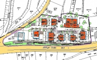
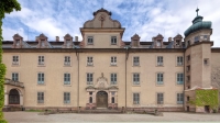
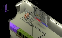
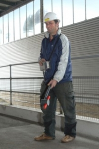

Inside the production
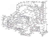
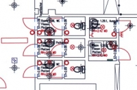
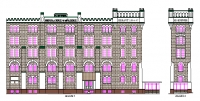
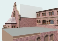
Industries
Processes & technical limits
| Processes | Tolerance | Max. part | Weight | Lot size | Materials |
|---|---|---|---|---|---|
| Surveying accompanying planning and construction surveyingEngineering | – | – | – | – | – |
| Surveying of renovation projects (geodetic, photogrammetric and scanner-based capture)Engineering | – | – | – | – | – |
| Construction-accompanying as-built surveys on large construction sitesEngineering | – | – | – | – | – |
| Quantity determination (digital terrain model, volume calculation in accordance with VOB)Engineering | – | – | – | – | – |
| Interior building survey with digital laser technologyEngineering | – | – | – | – | – |
| Façade surveyingEngineering | – | – | – | – | – |
| 3D animation for as-built records and planningEngineering | – | – | – | – | – |
| Deformation measurementsTesting | – | – | – | – | – |
| Locating and as-built recording of underground utility linesTesting | – | – | – | – | – |
| Room bookEngineering | – | – | – | – | – |
| Laser scanning (industrial and commercial buildings, technical installations, listed buildings)Testing | – | – | – | – | – |
| Fire safety plans (fire brigade plans DIN 14095, escape and rescue plans DIN 4844-3)Engineering | – | – | – | – | – |
| As-built recording of all above- and underground structures (e.g. tunnels)Engineering | – | – | – | – | – |
| Utility line cadastre (sewage, water, gas, electricity, telephone)Engineering | – | – | – | – | – |
| Hydrography (depth contour measurement with multibeam echo sounder, extraction monitoring, fairwayTesting | – | – | – | – | – |
4 Anlagen & Maschinen
| Machine | Manufacturer / model | Quantity | Working area | Year built | Site |
|---|---|---|---|---|---|
| Electronic locating device for underground utility lines | – | – | – | – | – |
| Multibeam echo sounder (hydrography) | – | – | – | – | – |
| Laser scanner | – | – | – | – | – |
| Digital laser technology (interior survey) | – | – | – | – | – |
Additional services
Quality
Compliance with the QM standard "Planer am Bau" (Planner on the Construction Site) is verified by annual audits by TÜV Rheinland; the most recent recertification took place in 2022.
| Evidence | Karlsruhe | Neuburg |
|---|---|---|
| Planer am Bau (TÜV Rheinland) |
History
- 2014
Introduction of the quality management system; certification according to the QM standard "Planer am Bau" by TÜV Rheinland in March 2014 as the first surveying office in the greater Karlsruhe area
- 2018
Merger of the surveying offices bugglin Ingenieure GmbH and VMB Michael Beßler to form bugglin beßler Ingenieure GmbH on 1 January 2018
- 2022
Recertification according to the QM standard "Planer am Bau" after annual audits