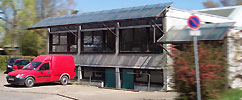
Publicly appointed surveying engineer for cadastral, construction and engineering surveying in Ostfildern

Ingenieurbüro für Vermessungen Dipl.-Ing. Heinz Wagner
Ostfildern (DE)New on Amplifa
About Vermessungsbüro Wagner
The engineering surveying office of Dipl.-Ing. Heinz Wagner is a publicly appointed surveying engineer under the Surveying Act of Baden-Württemberg, based in Ostfildern. The office offers comprehensive services in the field of cadastral, construction and engineering surveying. Its range of services includes cadastral surveys such as parcel subdivisions, boundary determinations, building surveys for the land register, land consolidations and street closure surveys. In the field of engineering and construction surveying, services include among others setting-out of construction projects, construction-accompanying surveys in civil and structural engineering, shape checks, settlement and movement measurements as well as precision plumbing. In addition, the office prepares calculations for architects, official site plans for building applications, as-built surveys and GIS data as well as land-use and development plans. Clients come from the fields of architecture, construction and real estate.
- Site
- Ostfildern
- Processes
- Cadastral surveys (parcel subdivisions, boundary determinations, building survey for the, Engineering and construction surveys (setting-out of construction projects,, Calculations for architects (buildable plot area, elevation conditions of building plots,, Site plans for building applications (official site plans for permit and notification procedures,, As-built surveys/plans GIS (topographic survey, utility and sewer cadastre,, Land-use/development plans (implementation of urban planning designs, preparation of plans,, Property surveys, expert reports, land readjustment, Cadastral surveys
- Materials
- Cadastral surveys, Engineering and construction surveys, Calculations for architects, As-built surveys and GIS, Land-use and development plans
- Certificates
- Publicly appointed surveying engineer (Surveying Act Baden-Württemberg)
- Industries
- Architecture, Construction, Real estate
- 01
Clarification of the assignment and construction law consulting
- 02
Surveying on site (cadastral, construction and engineering surveying)
- 03
Evaluation and calculation
- 04
Preparation of plans, site plans and expert reports
- 05
GIS data acquisition and data maintenance
Services and Methods
Cadastral surveys
Parcel subdivisions, boundary determinations, building surveys for the land register, land consolidations and street closure surveys.
Engineering and construction surveys
Setting-out of construction projects, construction-accompanying surveys in civil and structural engineering, shape checks, settlement and movement measurements as well as precision plumbing.
Calculations for architects
Buildable plot areas, elevation conditions of building plots and floor area calculations according to DIN 277.
As-built surveys and GIS
Topographic surveys, utility and sewer cadastres, terrain models, sections, profiles and earthworks volume calculations.
Land-use and development plans
Implementation of urban planning designs, creation and digitization of plans including GIS data acquisition.
Location
Ostfildern
DEOffice / engineering surveying office
Industries
Processes & technical limits
| Processes | Tolerance | Max. part | Weight | Lot size | Materials |
|---|---|---|---|---|---|
| Cadastral surveys (parcel subdivisions, boundary determinations, building survey for theEngineering | – | – | – | – | – |
| Engineering and construction surveys (setting-out of construction projects,Engineering | – | – | – | – | – |
| Calculations for architects (buildable plot area, elevation conditions of building plots,Engineering | – | – | – | – | – |
| Site plans for building applications (official site plans for permit and notification procedures,Engineering | – | – | – | – | – |
| As-built surveys/plans GIS (topographic survey, utility and sewer cadastre,Engineering | – | – | – | – | – |
| Land-use/development plans (implementation of urban planning designs, preparation of plans,Engineering | – | – | – | – | – |
| Property surveys, expert reports, land readjustmentEngineering | – | – | – | – | – |
Additional services
Quality and Authorization
As a publicly appointed surveying engineer under the Surveying Act of Baden-Württemberg, the office is publicly appointed and sworn.
| Evidence | Ostfildern |
|---|---|
| Publicly appointed surveying engineer (Surveying Act Baden-Württemberg) |