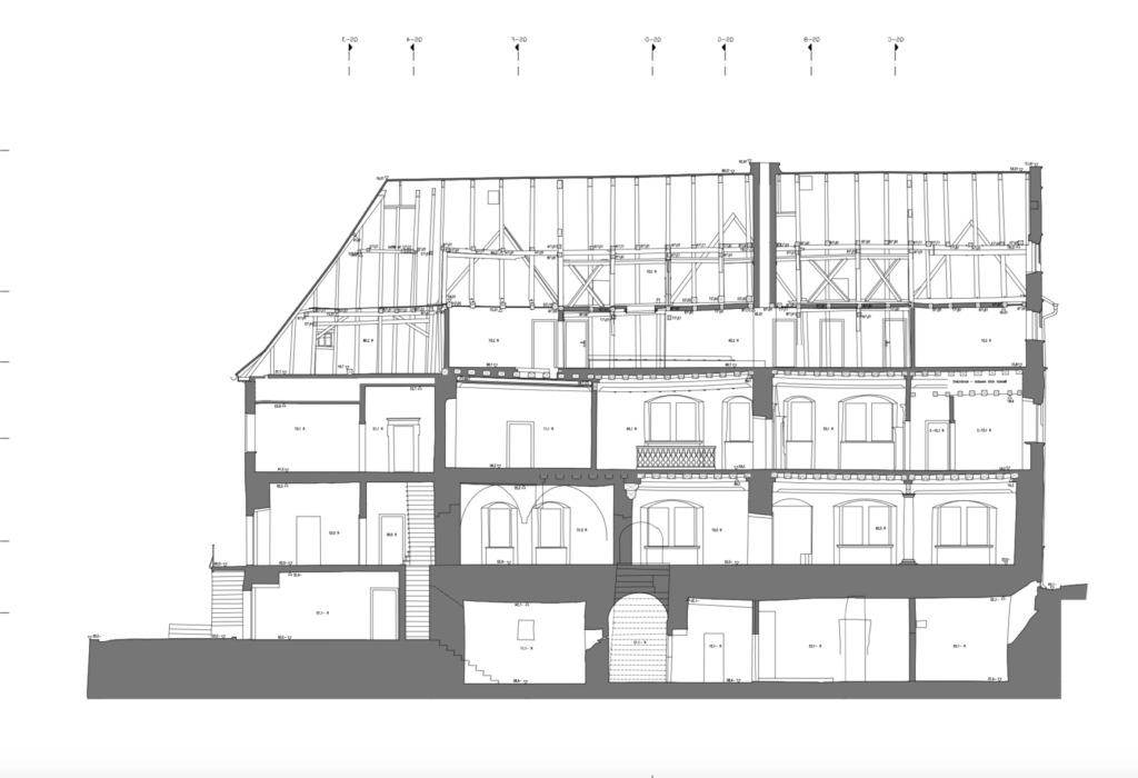
Building surveying and measurement with tachymeter, laser scanner and digital photogrammetry from Jena.

Photogrammetrie – Vermessung Alexander Kühn
Jena (Schillbachstraße 37, 07743) · Jena (Magdelstieg 138, 07745)New on Amplifa
About Photogrammetrie – Vermessung Alexander Kühn
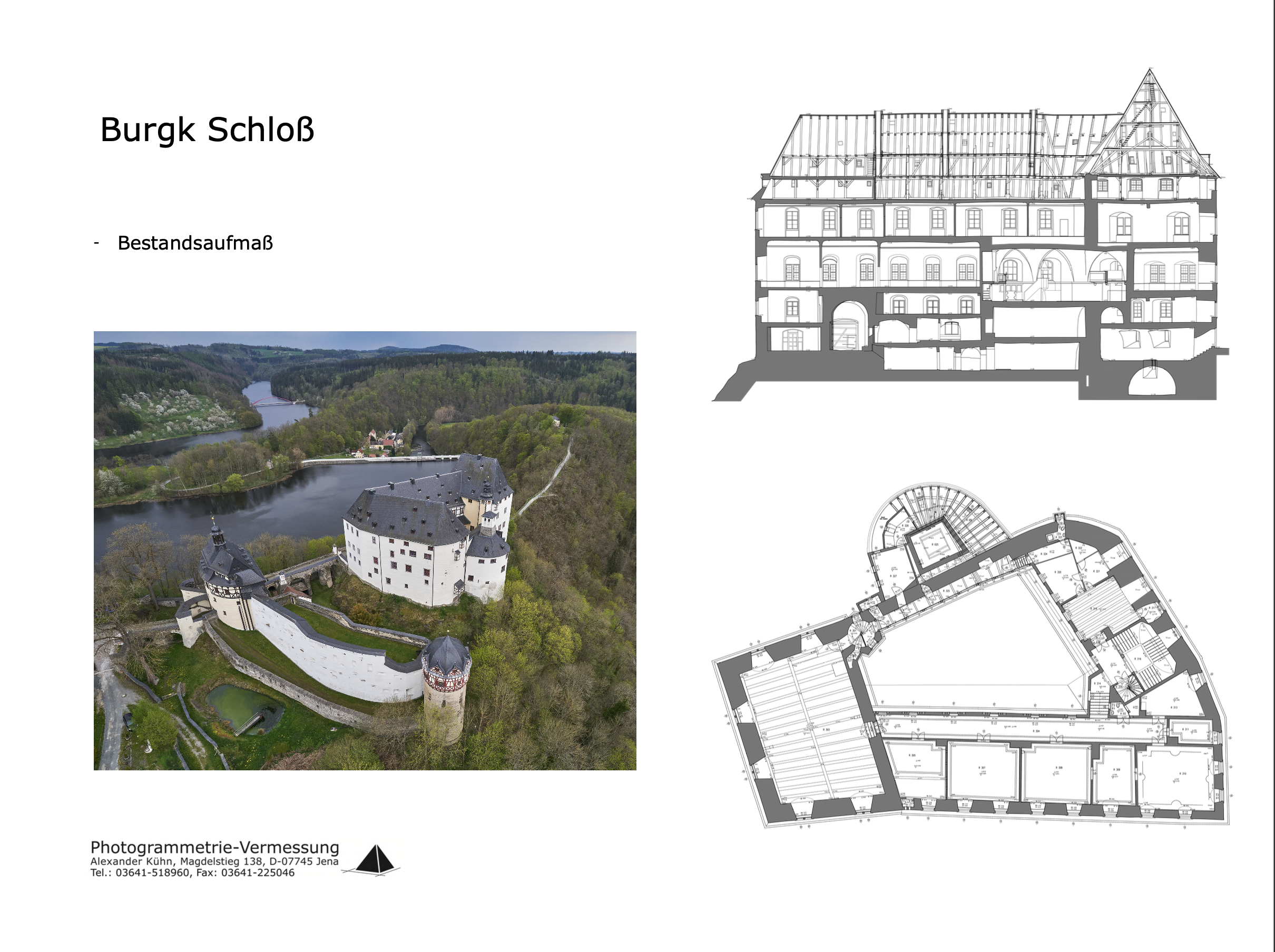
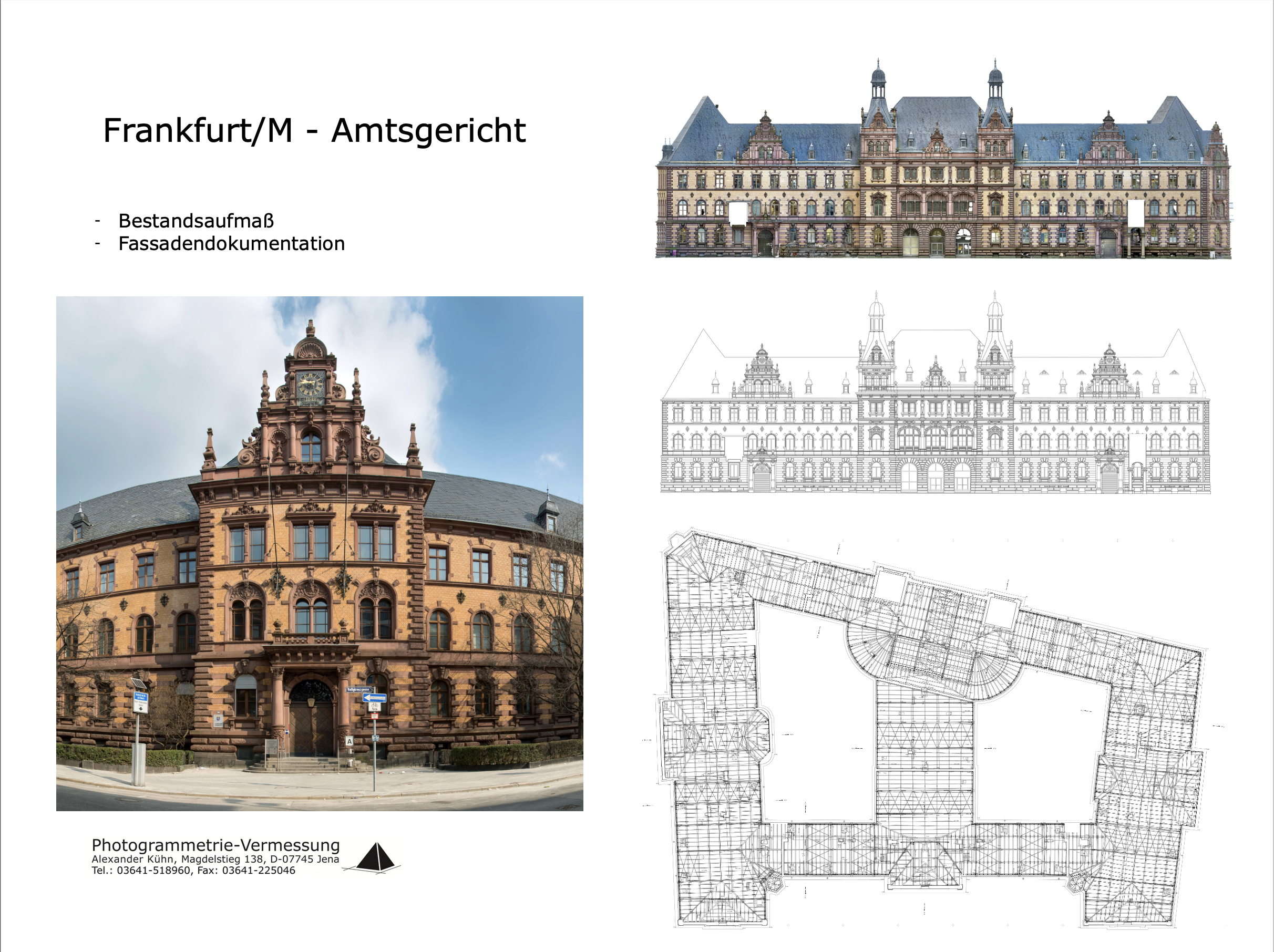
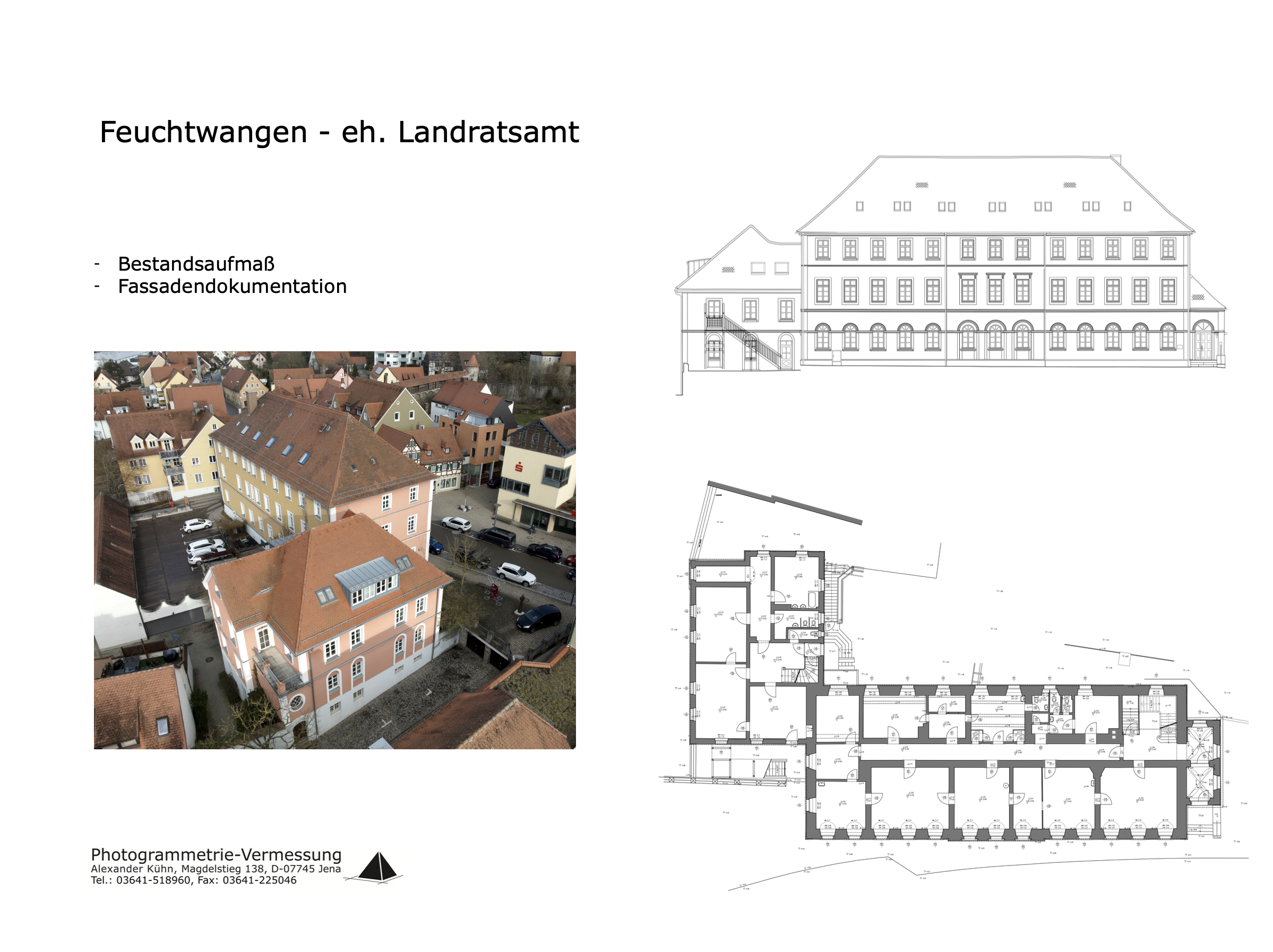
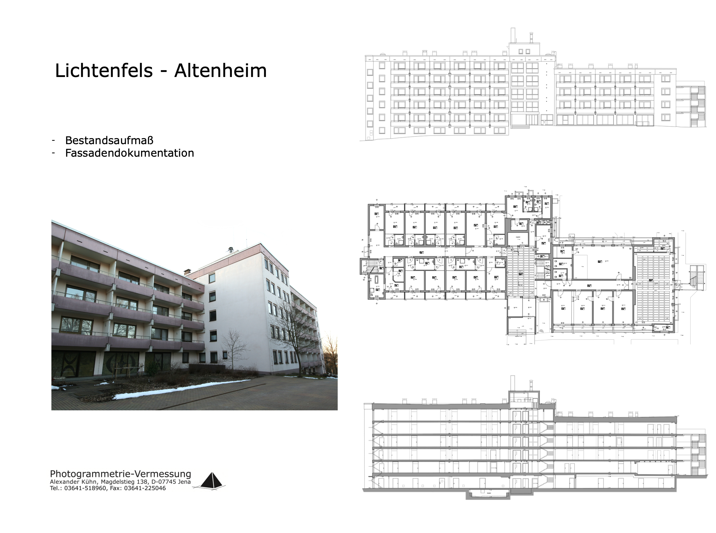
Photogrammetrie – Vermessung Alexander Kühn is a sole proprietorship based in Jena that specializes in building surveying and measurement, with a particular focus on listed historical architecture. The company produces 2D floor plans, sections, elevations, 3D BIM models, high-resolution orthophotos and 3D surface models in accuracy classes I–IV. Data acquisition is carried out with Leica tachymeters (1''–7''), FARO laser scanners (1 mm), drones and high-resolution Zeiss cameras with high-performance lenses. Using digital photogrammetry, hard-to-reach areas as well as structures with obstacles such as scaffolding or trees can also be captured without contact. Clients include private and public clients, planning offices and specialist authorities from architecture, construction planning, renovation and heritage conservation; results are delivered within two days of the survey.
- Site
- Jena
- Processes
- As-built surveying (tachymeter, laser scanner, drones/photogrammetry), Digital photogrammetry (2D/3D capture, orthophotos, 3D surface models, BIM models), Building surveying and measurement in accuracy classes I–IV (floor plans, sections, elevations, BIM, As-built surveying (2D floor plans), 3D BIM models, high-resolution orthophotos, 3D surface models, digital photogrammetry
- Materials
- Laser scanning (FARO), Digital photogrammetry, Tachymeter measurement (Leica)
- Certificates
- Accuracy classes I–IV (building surveying)
- Industries
- Architecture, Construction planning, Renovation, Heritage conservation, Public clients / specialist authorities, Planning offices
- 01
Clarification of requirements and on-site object capture
- 02
Tachymeter measurement or laser scanning / drone photogrammetry
- 03
Point cloud and image evaluation in the office
- 04
Creation of floor plans, orthophotos, 3D and BIM models
- 05
Delivery within 2 days of the survey
Surveying techniques and measurement methods
Laser scanning (FARO)
Non-contact on-site capture of point clouds with an accuracy of 1 mm.
Digital photogrammetry
Dimensionally accurate 2D/3D documentation with high-resolution Zeiss cameras, drones and special tripods.
Tachymeter measurement (Leica)
Conventional capture of building structures with accuracies from 1'' to 7'' and evaluation directly on site.
Locations
Jena, Schillbachstraße 37
DEBusiness address
Jena, Magdelstieg 138
DEOperating address
- Tachymeter (Leica, 1''–7'')
- FARO laser scanner (1 mm)
- Drone (UAV)
- High-resolution camera with Zeiss high-performance lens
- Special tripods
Services and survey results
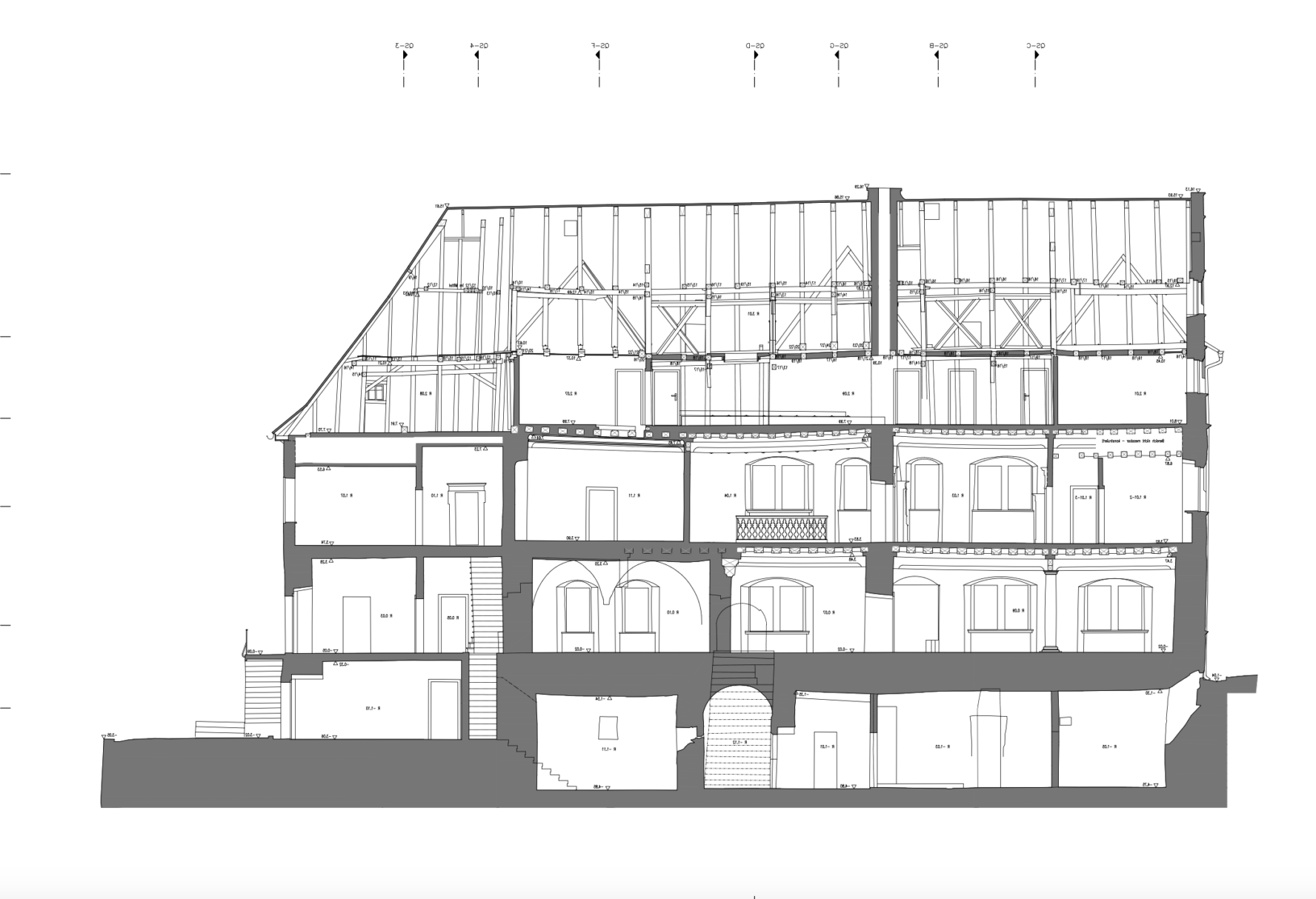
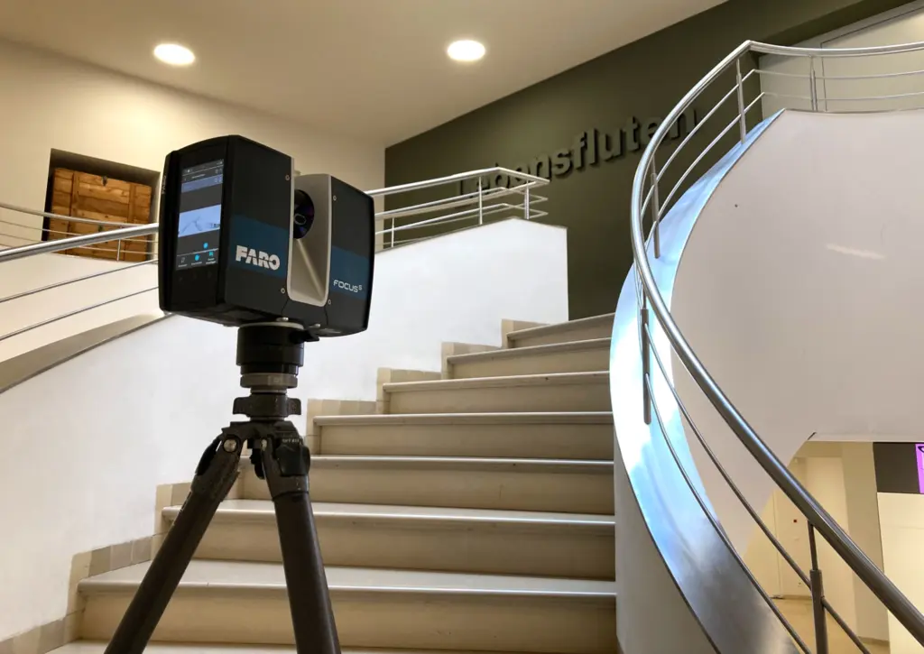
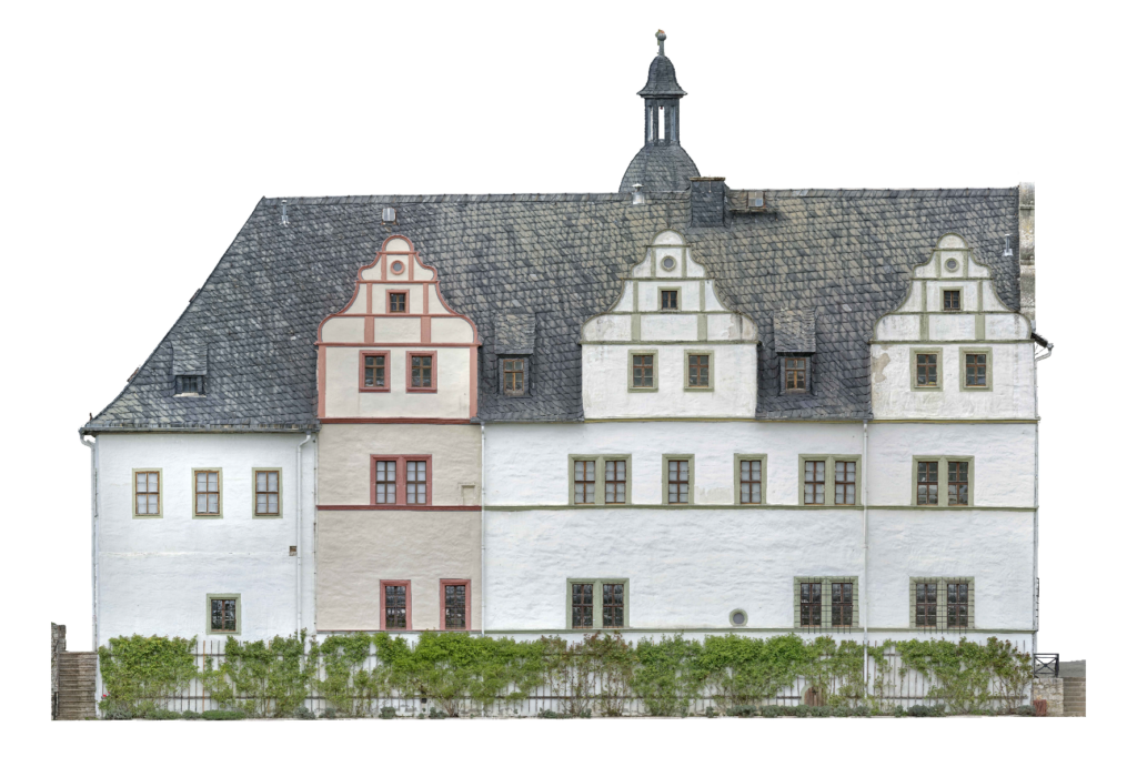
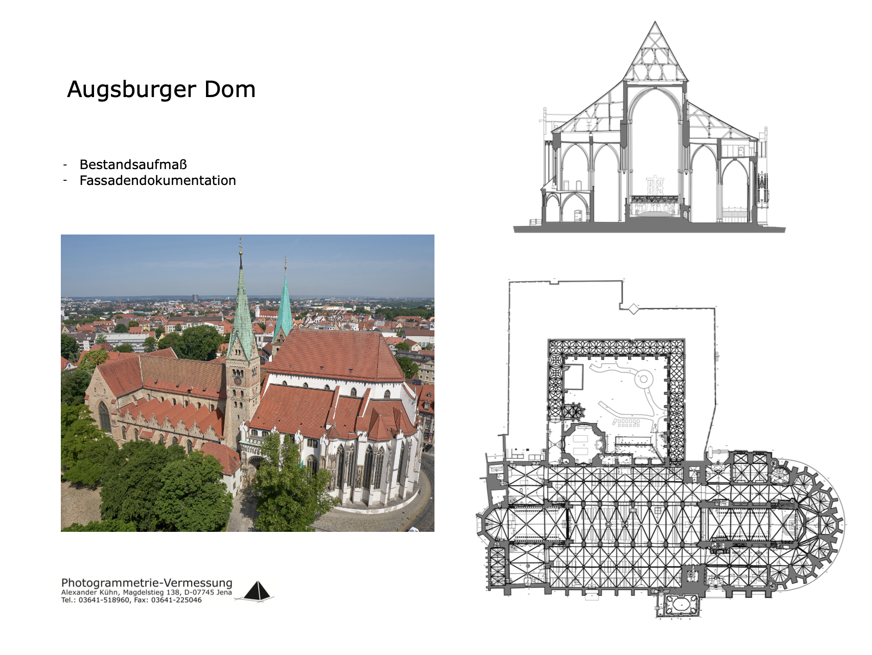
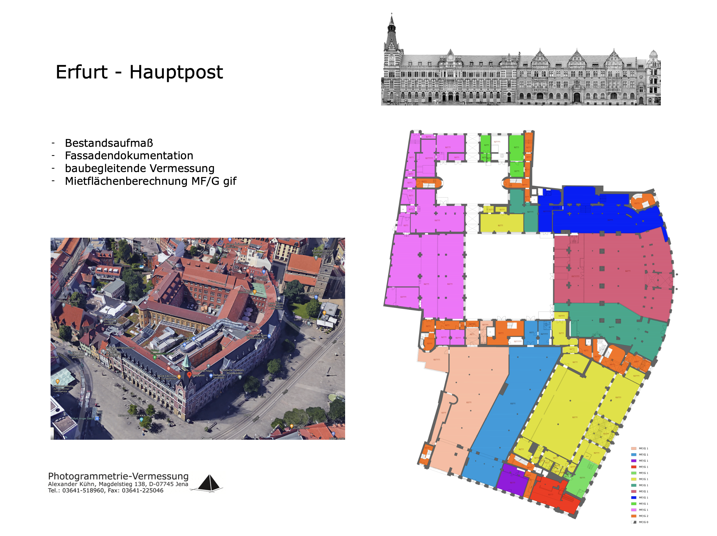
Inside the production
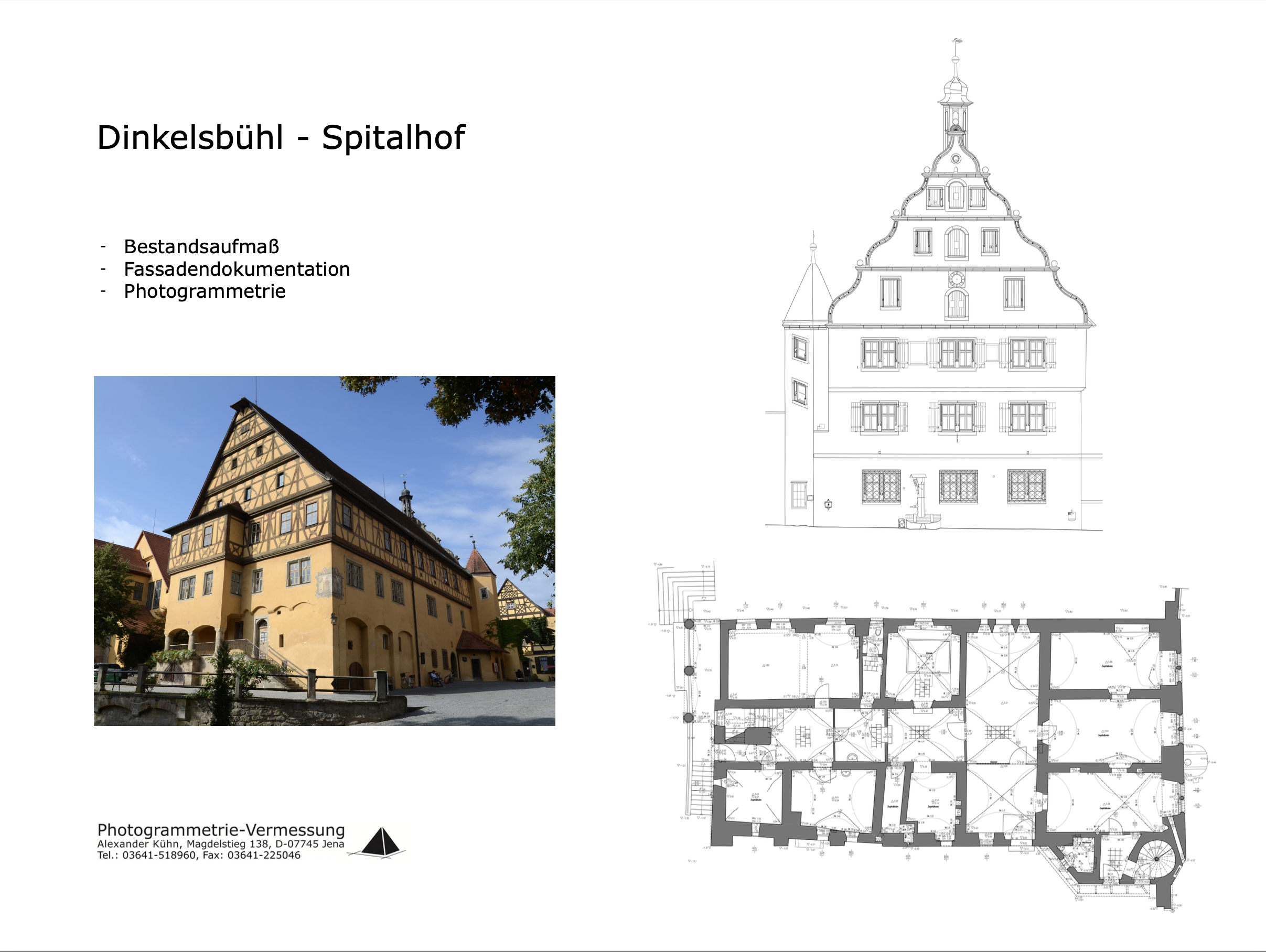
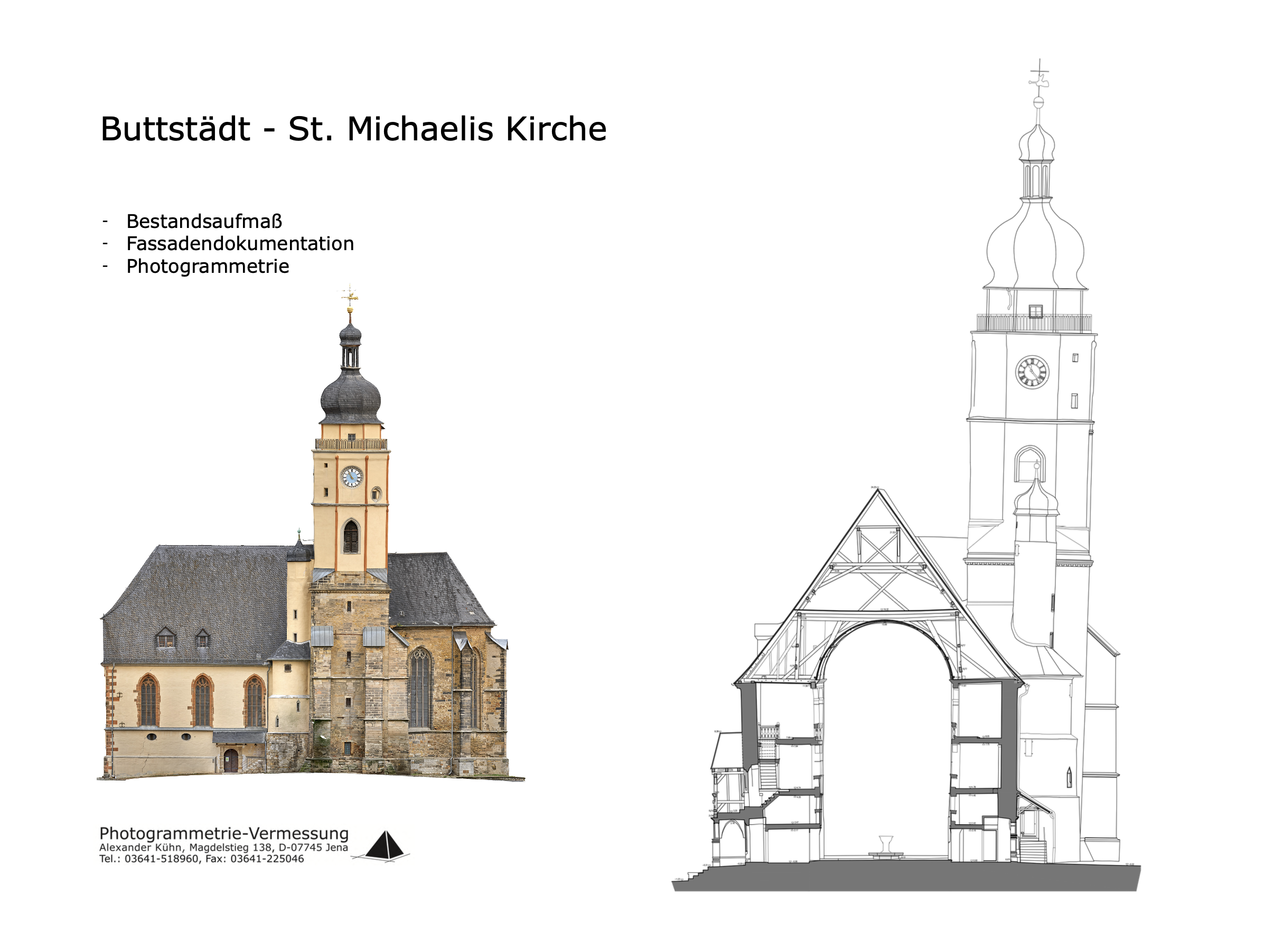
Industries
Processes & technical limits
| Processes | Tolerance | Max. part | Weight | Lot size | Materials |
|---|---|---|---|---|---|
| As-built surveying (tachymeter, laser scanner, drones/photogrammetry)Inspection | – | – | – | – | – |
| Digital photogrammetry (2D/3D capture, orthophotos, 3D surface models, BIM models)Inspection | – | – | – | – | – |
| Building surveying and measurement in accuracy classes I–IV (floor plans, sections, elevations, BIMInspection | – | – | – | – | – |
4 Anlagen & Maschinen
| Machine | Manufacturer / model | Quantity | Working area | Year built | Site |
|---|---|---|---|---|---|
| Tachymeter | Leica | – | – | – | Jena |
| Laser scanner | FARO | – | – | – | Jena |
| Drone (UAV for photogrammetry) | – | – | – | – | Jena |
| High-resolution camera with high-performance lens | Zeiss | – | – | – | Jena |
Additional services
Measurement accuracy and quality
Surveying is performed with Leica tachymeters with accuracies of 1'' to 7'' and FARO laser scanners with 1 mm accuracy; building surveys are delivered in accuracy classes I–IV.
| Evidence | Jena |
|---|---|
| Accuracy classes I–IV (building surveying) |