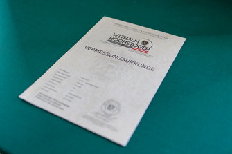
State-authorized chartered surveyors for cadastral and technical surveying, drone flights and 3D modeling in Freistadt
Vermessung Withalm & Hochstöger ZT OG
Schulgasse 6, 4240 Freistadt (AT)New on Amplifa
About Us
Vermessung Withalm & Hochstöger ZT OG is a state-authorized and sworn engineering consultancy for surveying, geodesy and geoinformation based in Freistadt in the Mühlviertel region of Austria. The family business, founded in 1955 by DI Leopold Withalm, is now run in its fourth generation. Its portfolio of services includes cadastral surveying with land subdivision, boundary re-establishment, boundary determination, boundary and map corrections, conversion to the boundary cadastre as well as land consolidation (Parifizierung). In the field of technical surveying, the firm performs position and height surveys, as-built plans, construction-accompanying surveys and staking-out, as well as monitoring measurements for deformation and settlement. In addition, the firm offers drone flights with photogrammetric evaluation, 3D modeling, volume (cubature) calculations and orthophotos, as well as consultancy services and advice on cadastral matters, land register and construction projects. Its customers come primarily from the property and real estate sector as well as the construction industry, operating in the Mühlviertel and beyond throughout Austria.
- Site
- Freistadt
- Processes
- Cadastral surveying (land subdivision, boundary re-establishment, boundary determination,, Position and height surveys (terrain survey, quantity determination), Creation of as-built plans (interior and exterior building surveys), Construction-accompanying surveys and staking-out (axes, building corners, height reference points), Monitoring measurements (deformation, settlement), Drone flights and 3D modeling (photogrammetric evaluation, volume calculations,, Consultancy services and advice (cadastre, land register, construction projects), Cadastral surveying
- Materials
- Technical Surveying, Drone Flights
- Certificates
- State authorization as chartered surveyor
- Founded
- 1955
- Industries
- Property/real estate, Construction
- 01
Order intake and consultation
- 02
On-site surveying and data acquisition
- 03
Photogrammetric evaluation or plan creation
- 04
Official submission and documentation
Services and Methods
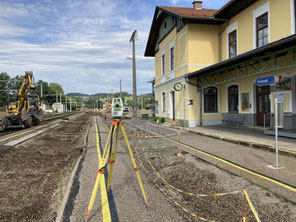
Technical Surveying
Position and height surveys, as-built plans, staking-out and monitoring measurements with high precision.
Drone Flights
Large-area surveys with photogrammetric 3D modeling, volume (cubature) calculations and orthophotos.
Location
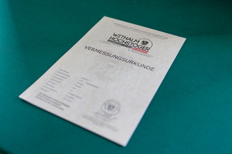
Freistadt
ATOffice and practice
- Drone for flight operations and photogrammetric 3D modeling
Services

Inside the production
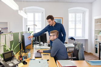
Industries
Processes & technical limits
| Processes | Tolerance | Max. part | Weight | Lot size | Materials |
|---|---|---|---|---|---|
| Cadastral surveying (land subdivision, boundary re-establishment, boundary determination,Engineering | – | – | – | – | – |
| Position and height surveys (terrain survey, quantity determination)Engineering | – | – | – | – | – |
| Creation of as-built plans (interior and exterior building surveys)Engineering | – | – | – | – | – |
| Construction-accompanying surveys and staking-out (axes, building corners, height reference points)Engineering | – | – | – | – | – |
| Monitoring measurements (deformation, settlement)Testing | – | – | – | – | – |
| Drone flights and 3D modeling (photogrammetric evaluation, volume calculations,Engineering | – | – | – | – | – |
| Consultancy services and advice (cadastre, land register, construction projects)Engineering | – | – | – | – | – |
1 Anlagen & Maschinen
| Machine | Manufacturer / model | Quantity | Working area | Year built | Site |
|---|---|---|---|---|---|
| Drone (for flight operations and photogrammetric 3D modeling) | – | – | – | – | Freistadt |
Additional services
Quality and Authorization
The services are provided as state-authorized and sworn chartered surveyors in accordance with the Austrian Act on Chartered Engineering Consultants (ZTG). The firm holds membership in the Chamber of Chartered Engineers, Architects and Engineers for Upper Austria and Salzburg.
| Evidence | Freistadt |
|---|---|
| State authorization as chartered surveyor |
Company History
- 1955
Company founded by DI Leopold Withalm with practice based in Freistadt in the Mühlviertel
- 1968
Company continued by DI Albert Withalm
- 2000
Company continued in the third generation by DI Roland Withalm
- 2014
Relocation of the office premises from Böhmergasse to Schulgasse 6 in Freistadt
- 2020
DI Simon Hochstöger joins the sole proprietorship
- 2022
Conversion into Vermessung Withalm & Hochstöger ZT OG with DI Roland Withalm and DI Simon Hochstöger as managing partners
- 2026
DI Maximilian Pühringer joins as managing partner and the chartered surveyor authorization of DI Roland Withalm is placed on dormant status